

Train Hits Car West Of Flagstaff Two Dead

New Home For Vet
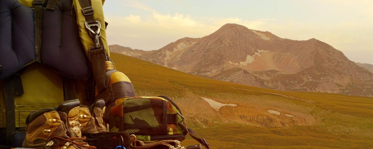
National Hiking Day (In Flagstaff & Everywhere) – Not a day will go by this year without a supposed national day celebrating something — mostly food. I’m sure that you’ve heard of them, either via your social media feed of coice or on the radio or during that hour of the Today show when they feature videos of water-skiing squirrels.
National Lasagna Day. National IPA Day. National Cookie Day.
National Hiking Day
The rest of this year brings days dedicated to whiskey sours, trail mix and waffles. Some of them are nonsensical, like last week’s Sneak Some Zucchini Onto Your Neighbor’s Porch Day.
Well today is no different. Today is National Hiking Day!
What is National Hiking Day?
Also known as “Take A Hike Day,” National Hiking Day on November 17 may be one of the most important holidays out there. Why? For starters, there’s more than 60,000 miles of trails across the nation. Not to mention, hiking is great exercise allowing you to burn over 550 calories per hour. Plus, being in the outdoors allows you to get away from your phone and appreciate nature’s beauty and wonder.
History of National Hiking Day
Hiking wasn’t always the fashionable pastime it is today. Before the Subarus and the Jeeps and the Patagonias built an industry around the activity, walking – of any kind – was considered an activity for the impoverished or the vagrant. Until the Romantic era of the Victorian years inspired the likes of Walden and Thoreau to reconnect with nature and that, in turn, inspired the landscape architects to design parks with excellent walking trails (looking at you Frederick Law Olmsted of Central Park fame). Walking then became something of the educated, the unhurried, the luxurious.
Until John Muir came along and walked his way through the Sierra Nevadas in California and demanded that not only hiking, walking, meandering, sojourning, whatever you want to call it be accessible to every American citizen, but that the country should actively preserve natural areas of pristine ecology and beauty. So in 1890 he petitioned for the creation of the National Park System and we were endowed with “America’s best idea” – Yosemite and Sequoia National Park.
But even before Muir, on the east coast a small group of people had banded together in 1876 to form the Appalachian Mountain Club, which had a goal to protect and preserve all hiking trails along the historic mountain range, as well as develop new ones.
So whether you prefer to hit the jogging trails in Central Park or are prepping to backpack the entire Pacific Crest Trail, every step on a trail is with a long line of explorers, trailblazers, and activists from before.
Some Great Hiking In And Around Flagstaff on National Hiking Day
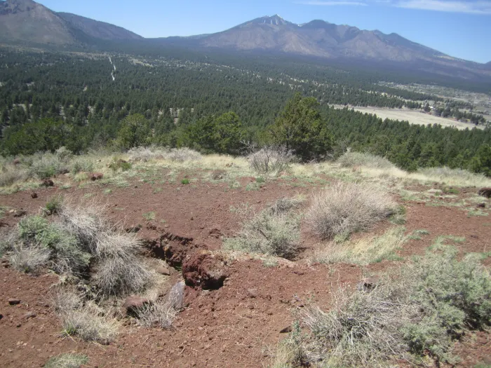
Red Mountain Trail
Explore a Natural Amphitheater in a U-Shaped Cinder Cone
2.6 miles round trip.
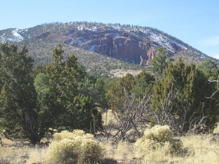
I love this hike. It’s only a couple of miles round-trip, but I can spend hours exploring in and around the hidden gem that awaits at the end of the trail, in the “belly” of Red Mountain.
From the trailhead, it’s an easy walk up a wide trail and a wash to your destination.
The only difficulty for small children and dogs along the way is a relatively short ladder not long before you reach the end of the trail. It’s not difficult to climb or descend the ladder, but children and dogs may need a lift.
Directions to the Red Mountain Trailhead:
The trailhead is located just off of Route 180, 25 miles north of Flagstaff. Look for a roadside sign indicating the turnoff, and drive a short way up a well-maintained dirt road to the parking area.Red Mountain from a distance
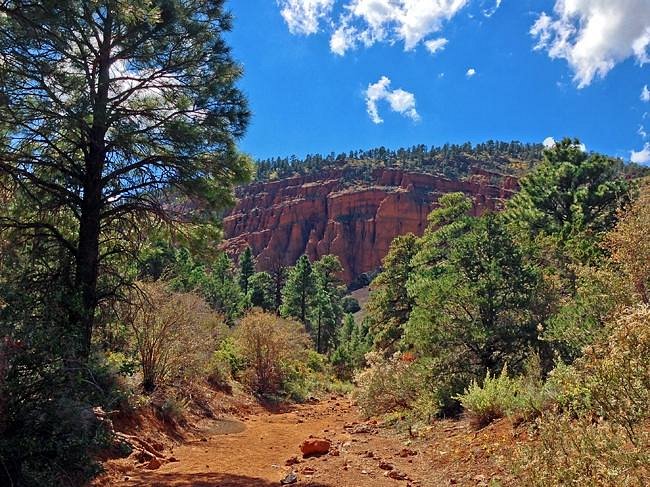
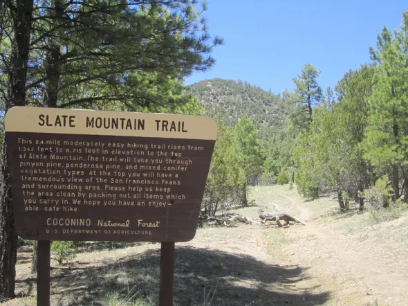
Slate Mountain Trail
A Nicely Graded Climb to Incredible Views of Northern Arizona
5 miles round trip.
This is a sweet hike. Sweet, as in a very pleasant, moderate walk, with wonderful views and well-groomed trail. And nice little interpretive signs along the way, identifying various flora (although the signs are old enough now that some of the plants they refer to have died).
I covered the two and a half miles to the top — about a 900-foot climb — in less than an hour, then parked myself on a convenient log and enjoyed the scenery, including Kendrick Mountain, the San Francisco peaks and Grand Canyon’s North Rim.
A hike up Slate Mountain is the perfect kind of hike to include in one’s vacation plans, because it’s not overly strenuous if you’re in decent shape, and it will reward you with a terrific overview of northern Arizona. There’s a nice open area at the top, just right for a picnic lunch. Later, when you return to your vehicle, and if you feel like doing some more walking, Red Mountain is just up the road.
Directions to the Slate Mountain trailhead:
From downtown Flagstaff, take Highway 180 north 35 miles to Forest Road 191 on the left. (There is a sign for Slate Mountain at the road, but it’s easy to fly right past if you’re going the speed limit. No big deal; there’s a road on the right a short distance ahead, where you can pull off and turn around.) Take 191 two miles to the trailhead on the right.
FS 191 is fine for passenger cars in dry weather, but don’t attempt it if it’s been raining unless you have 4wd. I drove it in a low-clearance car and was fine, though the road is rocks in some places.
Old Caves Crater Trail

Explore the Old Caves on Another Flagstaff Day Hike
2.4 miles round-trip.
I’ve done this hike up the old cinder cone several times over the years I’ve lived in Flagstaff. I like it because it doesn’t take all day (an hour or two, more like, not including exploring the caves and picnicking on the summit), it gets your heart pumping on the 500-foot climb but isn’t extremely difficult at all due to the long switchbacks, and the views at the top are outstanding. I also enjoy exploring the “old caves.”
The Old Caves Crater Trail takes you through volcanic cinder fields, pinon juniper forest, and Ponderosa pines as you climb this old volcano.
At the top of the trail, you can go right and visit the small caves, once inhabited by the Sinagua indians until about the mid-1300s, and then to the left to the summit. From there, the trail descends the other side of the crater and meets up with the main trail down at the bottom where you can continue back to the trailhead.
There is another trail, called the Crater Loop Trail, that circles all the way around the base of the volcano.
See trail maps of the Old Caves Crater and Crater Loop Trails on the Forest Service website.
Directions to the Trailhead:
This hike is located 3.5 miles northeast of the Flagstaff Mall off Hwy 89.
Drive north on Highway 89 from downtown Flagstaff to Silver Saddle Road. Turn right (east) on Silver Saddle and continue half a mile to the trailhead on the left, where there’s a fenced parking area.
National Hiking Day
Fat Man’s Loop
Get Some Exercise on Fat Man’s at the Base of Mt. Elden
2.5 mile loop.
The Fat Man’s Loop hike begins at the Elden Lookout Trailhead parking lot along Hwy 89. Soon after starting on the main trail, you’ll come to a fork. Take the right fork, pass through a fence and hike along the base of the mountain. In less than half a mile, you’ll see a sign for Fatman’s loop and Elden Lookout. Go to the left, towards Mt. Elden. From here, you’ll climb fairly steeply–yep, this hike has some ups and downs–and you’ll soon have views of Doney Park and the lava cliffs on Mt Elden.
At a mile and a half, you’ll come to another fork in the trail. Go right and you’d end up climbing Elden. To continue on Fat Man’s Loop, go left, which is downhill the rest of the way. The trail will lead you through gaps in large boulders, one of which is kind of a tight squeeze and the gap that gave Fat Man’s Loop its name.
At mile two, you’ll come to the junction with the Pipeline Trail. You’ll see a sign, with distances to the Oldham Trail & Buffalo Park.
Directions to Trailhead:
From downtown Flagstaff on Route 66/89, go east, past the mall and look for the Mt. Elden parking area on the left, with the split-rail fence around it. You’ll see a sign for the “Mount Elden Trail” and a paved driveway into the parking lot, which can get pretty full or fill up entirely on weekends, especially in the summer.
Viet Springs Trail
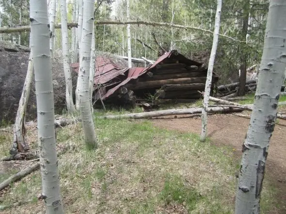
Easy and Beautiful Day Hike with Some History
1.5 miles round trip.
This loop trail is a beautiful, relaxing walk in the woods and through aspen-lined meadows. Along the way, you’ll come to a spur trail that leads to Ludwig Veit’s Cabin (pictured above), built in 1892. The 160-acre homestead has a storage shed and well you can explore. The cabin itself has been cut down to about 5 feet tall, so you can’t actually go inside. But it’s still fun to see.
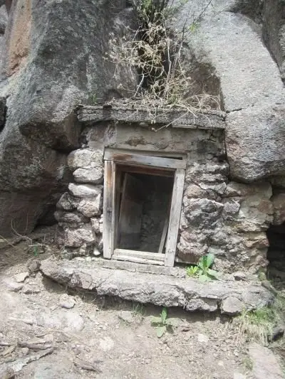
You’ll also see a plaque commemorating the late Lamar Haines and his efforts at wildlife preservation. Keep an eye out for pictographs on the rocks in this area. Walk around the “depression” in front of the spring house (you’ll see a worn trail) and look for a small cave, then on the rock face above it.
This is a great hike for the kids because of all the exploring there is to do around the old cabin and the nooks and crannies in the rocks. Once when I did this hike, I found wee little “shrimp-like” critters swimming around in a pool of water in a bowl-shaped boulder.
Directions to Trailhead:
From downtown Flagstaff on Route 66, take Humphreys Street north. Turn left at the light onto Ft. Valley Rd/Hwy 180. Go north on 180 to Snowbowl Rd. on the right. Take Snowbowl Rd. about four miles up till you reach the small trailhead parking area on the right. This is known as the Lamar Haines trailhead.
In the winter, you’ll see signs for “permit parking only.” The free backcountry permits are available at the Peaks Ranger Station.
National Hiking Day
Watchable Wildlife Trail
Enjoy the two loop trails with interpretive displays. One loop is handicapped accessible.
Up to 1.5 miles.
The Watchable Wildlife trail loops through the edge of Kendrick Park, which is a huge meadow surrounded by ponderosa pine and aspen, with excellent views of the San Francisco Peaks and Kendrick Mountain.
As the trail name implies, keep a lookout for all kinds of animals, such mule deer, elk, pronghorn, coyote, Abert’s squirrel, badgers. Birds you may see include the Steller’s jay, mountain and western bluebirds, mountain chickadees, violet green swallow, hairy woodpecker, and red-tailed hawks.
Directions to Trailhead:
The trail is approximately 20 miles north of Flagstaff on the southern end of Kendrick Park, west of Hwy. 180.
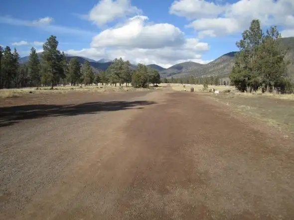
Aspen Nature Trail

A Trail Through the Hart Prairie
1.5 mile loop.
This loop hike offers a beautiful experience in the San Francisco peaks without a lot of strenuous work. It’s also a good hike to help you get acclimated to high elevation before undertaking other more difficult trails on the mountains. The Aspen Nature Trail trailhead is at an elevation of 9,271 feet.
From the trailhead, which you can see in the photo above, and along the hike, you’ll enjoy awesome views of Kendrick, Sitgreaves and Bill Williams mountains as you walk through aspen, fir and pine trees and alpine meadow. Follow the signs and look out for the intersection with the Arizona Trail.
Directions to Trailhead:
From downtown Flagstaff on Route 66, take Humphreys Street north. Turn left at the light onto Ft. Valley Rd/Hwy 180. Stay on 180 for to Snowbowl Rd. on the right. Take Snowbowl Rd. all the way up (7 miles) to the ski area, to the lower parking lot on the left. The trailhead is just below the end of the parking area, where the trail enters the aspen.
Several Easy Flagstaff Day Hikes from One Trailhead
Take Your Pick(s) on Campbell Mesa Loop Trails
I love to walk my dog and enjoy the fresh Flagstaff air during all seasons on Campbell Mesa trails, located in the eastern part of Flagstaff in the Country Club/Continental area.
Campbell Mesa offers five easy loop trails, varying in length from just over a mile to 5.7 miles. These gently rolling trails, which pass through open ponderosa forest and grassy meadows, are popular with hikers, mountain bikers and runners and, in winter, snowshoers and cross-country skiers. If you can go on a weekday during regular working hours, you’ll certainly have less company, but I’ve never felt crowded on these trails, even on a beautiful summer weekend.
The 4-mile Walnut Meadow Loop joins up with a half-mile connector to the Arizona Trail, if you want to extend your hike. Or, of course, you can hike more than one loop.
See Campbell Mesa Trail System maps on the Forest Service website.
Directions to Trailhead:
Take Rte 89 East from downtown Flagstaff, past Steve’s Blvd. and Fanning. Go right (south) on Continental, towards the I-40 on/off-ramps and Country Club.
Pass the golf course on the right and the Flagstaff Athletic Club on the left. Turn left onto Old Walnut Canyon Rd. (at the driving range).
The road is paved for a short distance and then turn to dirt (but a 2wd vehicle is fine). The road curves to the right. Look for the parking area with the gate on the left. From there, you can walk around the gate and access the multiple trailheads just a short distance ahead, both on the right and left sides.
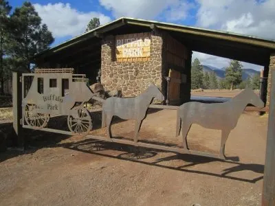
Buffalo Park Loop
Easy Trail for Walkers, Joggers, and Bikers.
2 mile loop.
Looks more like a dirt road, doesn’t it? But no motor vehicles are permitted in Buffalo Park (except an occasional, slow-going NFS or maintenance vehicle), only cyclists, walkers and joggers. Oh, and their dogs.
With a gorgeous view of the peaks, you can walk the 2-mile loop, which has fitness stations along the way, or snowshoe or ski the larger meadow in the winter. At the rear of the loop, you can access the Oldham Trail and head into the backcountry for a longer hike.
Be careful if you wander into the meadow surrounding the Buffalo Park loop. There are very sharp little cacti in the grass that will go right through sneakers.
Directions to Trailhead:
From Route 66/Downtown Flagstaff, take Humphreys Street north to Ft. Valley Road. Turn right at the light onto Columbus. Then it’s a short distance to the next traffic light at Beaver Street. Turn left on Beaver, pass the hospital, and then turn left onto Forest Ave.
Continue up the hill on Forest till you get to the traffic light at the top. You’ll see a sign for Buffalo Park and USGS. Turn left here and drive about half a mile to the parking area by the Buffalo Park gate.
There is no entrance fee. Just walk around the gate.
Here’s some more information about Buffalo Park from the City of Flagstaff website.
Griffith Spring Trail
Explore the Riparian Ecosystem
An easy 1 mile loop.
This is a very pretty walk in the woods and, at the bottom part of the loop, along a riparian area. The amount of water you’ll find here varies by season, but I’ve always found at least some small pools in the dryer months and as much as a flowing creek with a pond in late summer, during and after monsoon season.
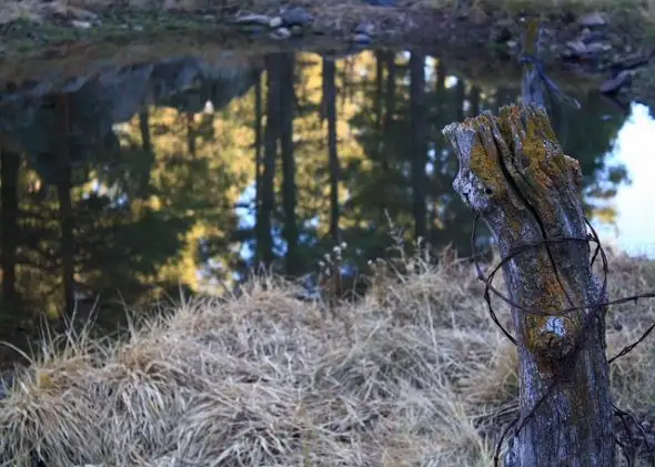
Griffith Spring runs into Pump House Wash, then eventually into Oak Creek. I’ve seen ducks here and other wildlife, including coyote and mule deer.
I’ve walked this trail many times and jogged it a few times too. It’s a relaxing walk at the end of a busy day or a great place for a picnic.
Directions to the Griffith Spring Trailhead:
From downtown Flagstaff, take So. Milton Rd/Route 66 south to Forest Meadows. Turn right on Forest Meadows, then left on Beulah. Continue South on Beulah / 89A approximately 2 miles past the Flagstaff Airport exit and Fort Tuthill. Look for the sign for the Griffith Springs day-use area on the left (east) side of Highway 89A.
A Guide To Easy Day Hiking in Flagstaff
This has concise descriptions and easy-to-follow maps of 20 leisurely hikes, from the slopes of the San Francisco Peak around the Flagstaff area.
If you’re a list-keeper like me, you could just start with the first hike in the book and do them all.
Be aware: even though many of these hikes are short or relatively short, the weather in Flagstaff can be extreme here at 7,000 feet and above and can change quickly. Please check the forecast before you go and carry the appropriate clothing and gear, even on a day hike.
Where did all of these seemingly random days come from?
The answer starts with online calendars that list the supposed “holidays.” There are dozens of varying popularity, but highly Googleable sites like National Day Calendar and Days of the Year , which display about 1,200 and 1,500 days respectively, are at the top. For food holidays in particular, it’s Foodimentary , which regularly broadcasts 450 food holidays to its more than 850,000 Twitter followers.
DANG!
From there, marketers, journalists and local businesses latch on, promoting different days for various reasons: to sell products, to bring people into their restaurant on a slow Tuesday. Hashtags are created, and a phenomenon begins.
But back to the origin. The United States recognizes only 10 days as national holidays, and they’re the big ones like Christmas and Independence Day. Go down a level and you’ve got government-sanctioned national observances, like Mother’s Day and Flag Day. But there are only 44 of those, and the closest any get to a wacky food holiday is National School Lunch Day.
Here is how the rest wound up on those calendars.
Sometimes, “national days” are created via presidential proclamation or a resolution in the House or Senate. On July 9, 1984, President Ronald Reagan signed Proclamation 5119 declaring National Ice Cream Day, praising it as a “nutritious and wholesome food.” Other Reagan proclamations included National Frozen Food Day, also in 1984, and Catfish Day on June 25, 1987.
The catch is that such proclamations are meant to be a one-time deal, so there technically hasn’t been an official National Ice Cream Day since the ’80s. But that didn’t stop shops across the United States from giving out free scoops on July 17.
Marlo Anderson, 53, founder of National Day Calendar based in Mandan, N.D., says only a small fraction of celebrated days have any whiff of government officialness. Others may have been proclaimed at one time on a state, city or county level, and spread outward. Some are rooted in local traditions or history, such as the massively popular National Doughnut Day. While that day now centers around freebies, it sprang from the Salvation Army’s practice of serving doughnuts to soldiers on the front lines of World War I, where resourceful “doughnut lassies” fried the dough in soldiers’ helmets.
A fair amount of national days are invented by organizations or companies looking to drum up interest. That’s where you get National Drive-Thru Day, created by the fast-food chain Jack in the Box, or National Underwear Day, from the online underwear retailer Freshpair.
And yet others are simply made up by random people. John-Bryan Hopkins is the social media consultant from Alabama who created Foodimentary, which he started by compiling about 200 food holidays that already existed in some form. He readily admits to then making up Tater Tot Day, National Whiskey Day and others starting in 2006 as a way to fill up the rest of the calendar.
“Early on, I’d wake up in the morning and realize I didn’t have anything for the blog that day,” he said. “I’d think, ‘What day can I make today?’ “
Jonathan Alderson, who runs Days of the Year with Samantha Simpson, doesn’t see a problem with that.
“To some degree, all holidays are ‘made up,’ Christmas, etc., included. Arguably, they’ve just been around for longer,” he wrote via email from London. “Burger Day, as our go-to example, was very definitely made up. But if everybody celebrates it, does it matter whether it was a formal proclamation by a president … or a whim-gone-viral which brings a smile to people’s faces? I’m not convinced that there’s much difference.”
Well, either way – HAPPY NATIONAL HIKING DAY!! ENJOY!!!

Get all the LOCAL, NATIONAL & WORLD news from Maricopa, Casa Grande & the rest of Pinal County & surrounding areas…
